Seamless Modeling
Intelligent GIS Mapping Solutions That Turn Data into Insight
ASC Technology Solutions is a provider of complete GIS Mapping solutions that can assist corporate companies and government agencies in making smarter decisions that are based on location.
We work in the field of spatial data analysis, GIS database management, and, of course, specialized mapping solutions related to different industries, which include transportation, agriculture, utilities, and urban planning. Our GIS specialists convert complicated geographical information into actionable intelligence that promotes planning and the efficiency of operations. With industry knowledge and integrated high-level GIS technologies, we can assist organizations by visualizing patterns, managing assets, and optimizing workflow. All solutions will be made to pair with practical demands and long-term goals. We are interested in precision, makeability, and usability. The outcome is better geospatial awareness that leads to bold decision-making.
Our Valued BIM Clients
Trusted by industry leaders across projects and geographies
1000+
Client served around the globe
Impactful design
Strategic GIS Consulting for Smarter Location Intelligence
The GIS Mapping and Consulting services provide our customers with the power to discover the maximum potential of their geospatial information with the help of great analysis and planning. Trends, relationships, and insight are then found using cutting-edge spatial tools and will enhance efficiency and innovative solutions. ASC Technology Solutions are outsourced GIS services that are cost-effective and provide high-quality services without complicating the operations. We make sure that the GIS systems are consistent with business objectives and future developments. We assist clients in deploying geospatial solutions that are reliable and scalable, without the need for in-house data processing. Every project is dealt with accurately and clearly. This allows organizations to concentrate on expansion by using potent location intelligence.
Transformative Solutions
Our Extensive GIS Mapping & Consulting Services
Turning complex ideas into practical, high-quality outcomes while empowering clients to achieve success with confidence and clarity.
Data Digitisation and Management
We transform the quality physical maps and paper records, as well as old physical spatial data, into accurate digital forms. Our GIS specialists ensure that data will integrate without any problems and that all things will be standardised to maintain safe storage. Our progressive geospatial database systems and cloud computing enable businesses to conduct effective spatial information management that enhances decision-making and operational processes.
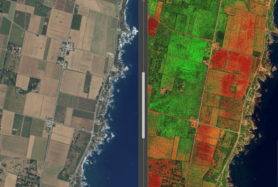
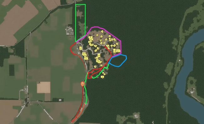
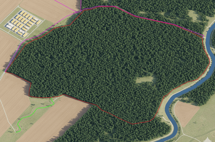
Satellite Imagery Analysis
With high-resolution satellite imagery analysis, we get vital monitoring data and insights into the environment to respond during a disaster, and city and agricultural resources planning tools. We utilise the power of remote sensing, AI image processing, and change detection algorithms to decipher and realize spatial data.

Surveying and Data Collection
Our organisation provides precise land, infrastructure, and utility surveying services through complex GIS, LiDAR, and GPS technology services. Our solutions allow organisations to deal with geospatial data collection in construction, transportation, and their assets. Our capabilities to provide ground-based surveys, drone mapping, and mobile LiDAR scans make it possible to give accurate data on the spatial information with the highest level of accuracy.
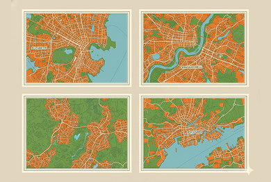
Custom Cartography
Our team develops business-specific and high-quality functional designs and customised maps of superior visual quality. We also generate interactive web maps and thematic and geospatial visualisations of maps, which are used by businesses in tourism, urban planning, and logistics sectors. With the use of GIS-based mapping solutions, data can be easily visualised, making the complex spatial data understandable and easy to use in decision-making.
How We Work
Our BIM Workflow
We have combined technical skills with real project knowledge to provide quality BIM-based solutions. From early concept to detailed execution, we strive to make the right decisions, collaborate, and create long-term value that helps make decisions smarter and project-based results successful.
01
Concept & Consultation
The first step we take towards your project is to know about your objectives and the technical challenges of the project. Our professionals work hand-in-hand with the stakeholders to establish the scope, expectations, and a solid ground for efficient and quality delivery of the BIM.
02
Design & Planning
Our team is able to produce coordinated BIM models that are clear and precise, reflecting design intent. We also plan and validate to ensure there is an optimized workflow, fewer conflicts, and improved coordination of all project disciplines.
03
Development & Execution
We have approved designs that we convert to fine BIM models, ready to construct. Our execution phase stresses compliance and accuracy which the effective coordination is achieved, and the rework is reduced, enabling projects to proceed smoothly.
04
Final Delivery & Handover
We provide complete validated BIM models and documents depending on the project requirements. We have a well-organized handover approach that guarantees a seamless transition operation, and proper data accessibility with long-term functionality to the construction, operation, and facility management teams.


- 2k+
Align with Businesses that Choose Quality
Recent Projects
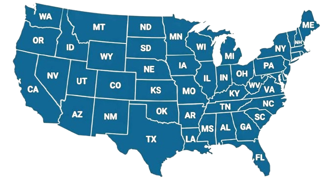
2,500+ BIM Modeling Services Projects Across the USA


Unlock advantages
Benefit Yourself By Working With Us
- Facilitates access to advanced GIS technologies and professional geospatial computation, negating the need to invest in in-house infrastructure or special resources.
- Helps organizations concentrate on their internal activities, while they get the correct and exact mapping that has been fair and dependable by ASC Technology Solutions.
- Produces quality spatial visualizations that enhance decision-making and give a better understanding of the planning, development, and operational strategies.
- Promotes the data-based results of various projects and industries.
- Improves project workflows through better streamlining of spatial data processing, analysis, and reporting, thereby making its business processes faster and more efficient.
- Minimizes complexity, enhances the overall level of coordination and clarity.
- Enhances planning effort, resource investment, and infrastructure growth with the help of accurate geographic knowledge and localization.
- Assists organizations in reducing risks and making maximum use of projects.
- Lowers cost of operation through providing scalable GIS solutions that are responsive to project needs in the long run without incurring front-end overheads.
- Both cost-efficient and, at the same time, high-quality deliverables.
- Enhances geospatial strategies in terms of professional consulting and streamlined GIS applications that enhance sustainable development and prolong live project.
- Helps organizations to develop strength and visions of data infrastructure.
Client Success Stories
What Clients Say About Our GIS Mapping Work
Client voices that reflect our data accuracy, clear consulting, and dependable project support.


Thank you guys for completing the project on time. We are happy the way specs were understood and implemented by ASC team. Look forward to work with you guys again.

The turnaround time was short and we used ASC team as extended BIM team for coordination and shop drawings. We liked the communication and quality deliverables.

ASC was quick and responsive despite working in different time zone. We had few challenges due to limited space but the complexity was well managed by ASC team. The quality of the spool and fabrication drawings were exactly what we were expecting.

Model insights
Sample Drawings
Take a closer look at our sample drawings to see how we transform complex project requirements into clear, precise outputs.
Your Guide
FAQ
GIS Consulting specialists help organisations deploy Geographic Information Systems (GIS) to analyse data and create maps while enabling spatial decision-making processes. Consultants enable organisations, together with public agencies, to deploy GIS technology effectively for structural planning alongside resource control and business operational system enhancement.
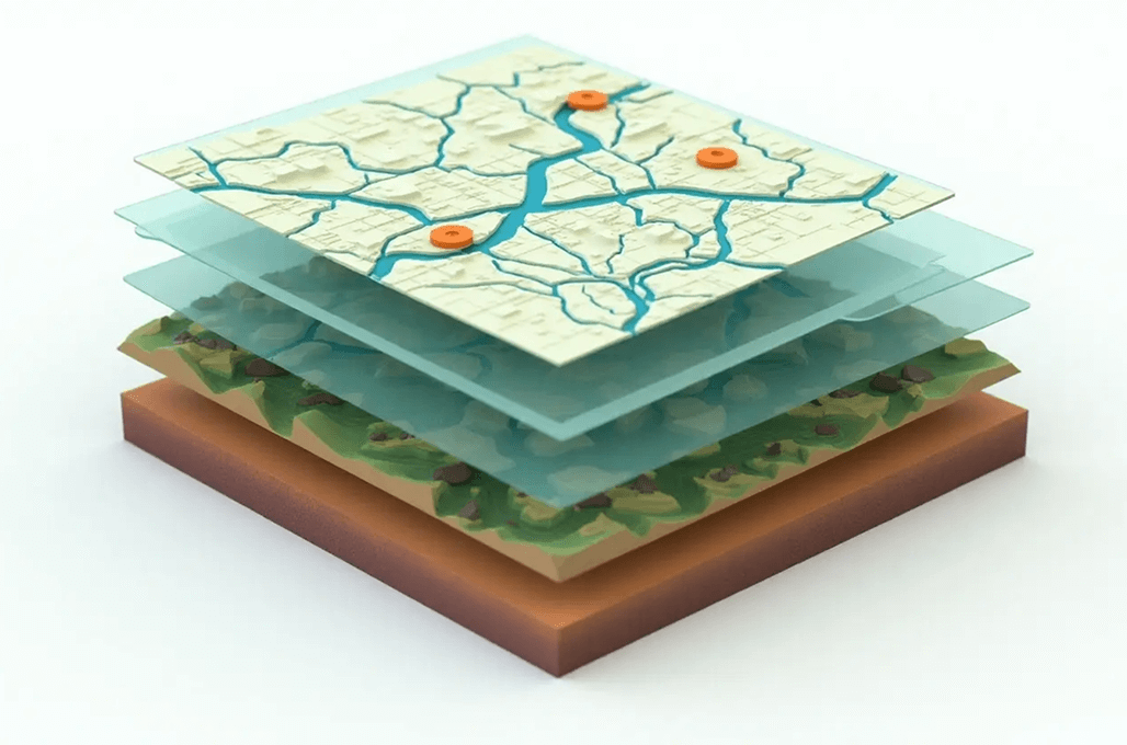
GIS Mapping performance depends directly on three crucial aspects: The quality of data sources, Spatial image resolution, and Exact methods of data gathering. The combination of high-resolution satellite imagery with LiDAR and advanced survey methods enables GIS mapping to reach precision levels at the sub-meter to centimetre scale.
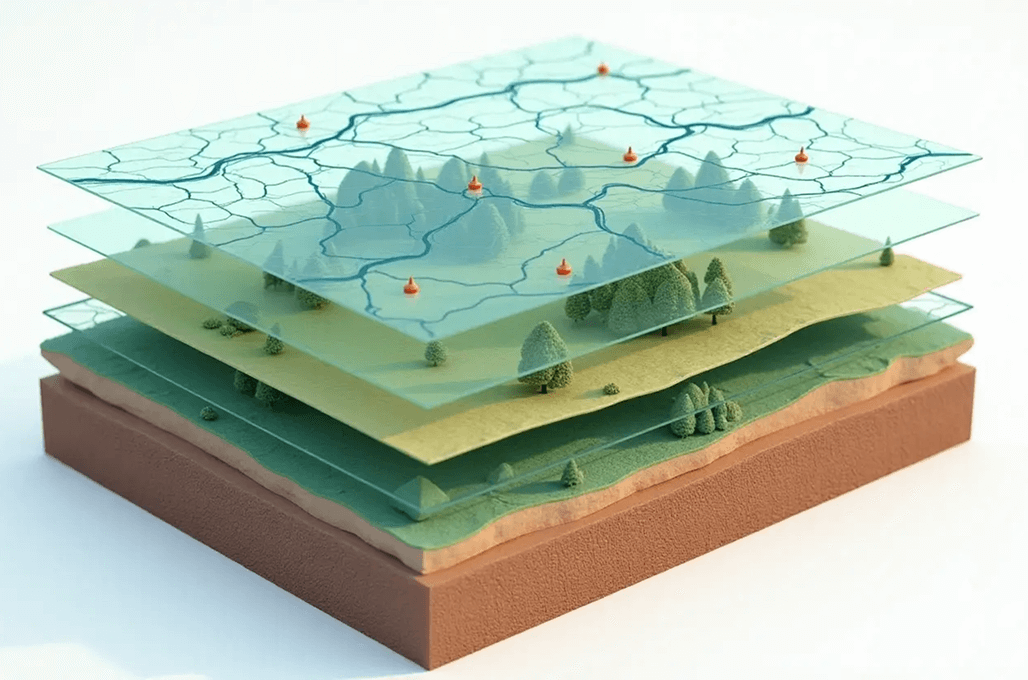
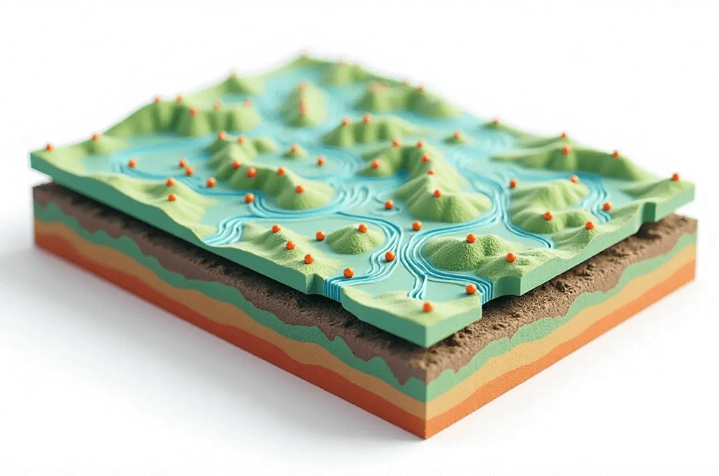
GIS systems enable the combination of different data sources, including satellite imagery, aerial photographs, GPS coordinates, census data, infrastructure layouts, demographic data, and environmental information. The system enables thorough spatial investigations and makes decisions more perceptive.
GIS Mapping establishes spatial data representations through the integration of geographic data with different datasets. Visual representations with pattern relationships and trends arise from GIS that enable this technology to serve as a valuable mechanism across urban development projects, environmental observation, and infrastructure maintenance.
Organisations within urban planning, environmental management, transportation, real estate, agriculture, telecommunications, and public safety sectors receive advantageous insights from GIS consulting services. Through GIS analysis, organisations gain better decisions, improved operational effectiveness, and maximised resource utilisation.